Who the route suits
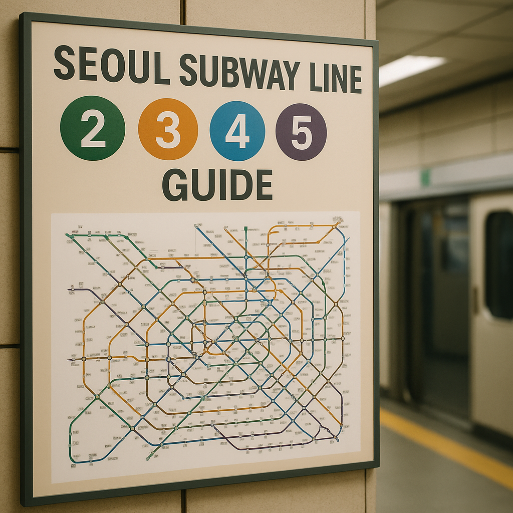
The Seoul subway line 2 3 4 5 guide is useful for travelers who want to connect central neighborhoods, major museums, markets, and transport hubs without changing hotels. These four lines cover different sightseeing patterns, so choosing the line before choosing an attraction can reduce backtracking and make admission times easier to keep.
Line 2 is the practical backbone for a first stay because its circular route links areas such as Hongdae, Sinchon, Euljiro, Dongdaemun History & Culture Park, Jamsil, Gangnam, and Seoul National University. Lines 3, 4, and 5 add efficient north-south or east-west movement, making them suitable for travelers combining palaces, traditional markets, cultural venues, and airport or rail connections.
- First-time visitors: Line 2 provides a broad orientation, while Lines 3 and 4 connect well with historic districts and major stations.
- Culture-focused travelers: Line 3 is convenient for Anguk, Jongno, and express connections toward southern Seoul.
- Market and downtown travelers: Line 4 serves Myeongdong, Hoehyeon, Dongdaemun, and several central transfer points.
- Travelers avoiding steep walking: Line 5 can be useful for moving across the city, but station exits and underground passages still require careful checking.
Transport route
Seoul subway signs use line colors and station numbers, but a transfer can involve a long walk between platforms. Before leaving, save the destination station in Korean and check the exit number, because the nearest exit may be more important than the station itself when a museum, market, or reserved venue has a fixed entry time.
| Line | Useful travel pattern | Typical planning value |
|---|---|---|
| 2 | Hongdae, Euljiro, Jamsil, Gangnam, and major transfer stations | Broad city orientation and flexible neighborhood hopping |
| 3 | Gupabal, Jongno, Anguk, Express Bus Terminal, and southern districts | Palace-area access and north-south movement |
| 4 | Seoul Station, Hoehyeon, Myeongdong, Dongdaemun, and northern routes | Central sightseeing, markets, and rail connections |
| 5 | Gimpo Airport direction, Yeouido, Jongno, and eastern Seoul | Long cross-city journeys with fewer surface-road delays |
For route checking, use the current Seoul Metropolitan Government transport information and station maps rather than relying only on a saved screenshot. The Seoul travel collection can help with neighborhood planning, while the official Seoul Metropolitan Government site is the better reference for city transport notices and policy changes.
At a transfer station, follow the colored line signs and allow extra time for escalators, underground corridors, and platform changes. A route with one additional stop but a simpler transfer may be more comfortable than the shortest route, particularly with luggage or during the evening commute.
Timed itinerary
A four-day plan can assign one main line to each day while keeping the schedule adaptable. The sequence below is a transport framework, not a list of guaranteed opening hours; confirm each venue’s admission rules before setting a reservation time.
- Day one, Line 2: Begin around Hongdae or Sinchon, continue toward Euljiro or Dongdaemun History & Culture Park, and finish in Jamsil or Gangnam. Keep the first day light because Line 2’s circular route offers several easy places to shorten the plan.
- Day two, Line 3: Use Anguk or Jongno for a palace and traditional-neighborhood schedule, then continue south if a timed museum or performance is booked near Express Bus Terminal. Put the fixed admission first and use nearby streets as flexible stops.
- Day three, Line 4: Start near Seoul Station or Hoehyeon, move through Myeongdong, and continue toward Dongdaemun. This arrangement works well when a market visit and a central cultural venue are combined, but leave a buffer for crowded passageways.
- Day four, Line 5: Choose either the western airport-side direction, Yeouido, central Jongno, or the eastern section according to the accommodation location. Avoid crossing the entire line solely for one attraction when a similar option is available closer to the hotel.
For a shorter stay, combine Lines 2 and 4 for central neighborhoods, then use Line 3 or 5 for one focused half-day. Travelers continuing to Jeju should keep the final Seoul day close to the airport or rail connection, depending on the confirmed departure point.
Current costs and reservations
Subway spending depends on the fare product, travel distance, age category, and whether a visitor uses a rechargeable transport card or another eligible pass. Fares and pass conditions can change, so check the Seoul Metropolitan Government’s current guidance before loading credit; avoid treating a fare displayed in an old travel post as a permanent price.
- Single journeys: Useful for a limited number of rides, but the purchase process may take longer at busy stations.
- Rechargeable cards: Convenient for repeated subway and bus travel, with balance and refund conditions that should be checked before departure.
- Short-term passes: Worth comparing when the itinerary has several rides each day, although validity, eligible services, and purchase locations can differ.
- Admission tickets: Museums, palaces, observation venues, performances, and special exhibitions each set their own prices, closures, and reservation rules.
Book timed admission before arranging a tight subway sequence, especially for popular exhibitions, performances, or venues with a daily capacity. Save the confirmation in offline form and record the venue’s entrance name, since the station exit and the ticket gate may be on different sides of a large block.
Official visitor information from the Korea Tourism Organization is a useful starting point for attraction access and seasonal notices. If your itinerary includes hospital appointments, coordinate travel time separately and consult the Medical Tourism resource rather than assuming a sightseeing route will allow enough time for registration or consultation.
Accessibility and seasonal cautions
Accessible travel is possible on these lines, but “accessible station” does not always mean that every entrance has a lift or that the most convenient exit is step-free. Check the station map for elevators, accessible toilets, platform locations, and transfer routes, then add time for a detour if the nearest lift is at another exit.
| Travel condition | Planning adjustment |
|---|---|
| Luggage or mobility equipment | Choose elevator-marked entrances and avoid transfers with long corridors where possible. |
| Rainy or humid periods | Allow time for wet floors, umbrellas, crowded platforms, and slower street walking after the exit. |
| Cold weather | Keep outdoor palace and market segments shorter and place indoor admissions near a station. |
| Peak commuting periods | Do not schedule a narrow timed-entry window immediately after a long transfer. |
| Holiday or festival periods | Recheck venue closures, crowd controls, and temporary station or road arrangements. |
Heat, cold, rain, and fine dust can make an itinerary feel longer because many Seoul stations require surface walking after the train ride. A practical seasonal plan groups two nearby stops together, keeps a flexible indoor alternative, and confirms the last train information when returning to accommodation outside the central area.
Station names may appear in Korean and English, but announcements can be easy to miss in a crowded carriage. Keep the next station, transfer line, and exit number visible on your phone, and ask station staff for help when a lift route or platform direction is unclear.
Official links and checked date
Use the Seoul Metropolitan Government for transport policies, station-related notices, and city guidance, and the Korea Tourism Organization for destination and visitor information. These sources are more reliable for changes to fares, operating arrangements, closures, and admission procedures than undated route summaries.
Checked date: 2026. Transport fares, pass eligibility, station facilities, attraction hours, and reservation requirements can change after publication, so confirm the relevant official page before departure.
For broader route ideas, return to Korea Travel and compare the subway plan with accommodation location, airport movement, and any onward domestic travel. A route that is slightly less ambitious but leaves room for transfers and admission checks is usually the more dependable choice.
자주 묻는 질문 (FAQ)
Which Seoul subway line is best for first-time visitors?
Line 2 is a useful starting point because its circular route connects Hongdae, Euljiro, Jamsil, Gangnam, and several major transfer stations.
How should I plan subway transfers for timed admissions?
Check the station exit, transfer walking distance, and elevator route, then leave a buffer before the venue’s entry time rather than scheduling consecutive journeys.
Are subway fares and passes fixed?
No. Fares, pass conditions, and eligible services can change, so confirm current details through Seoul Metropolitan Government guidance before travel.
Which line is useful for palace and traditional-area travel?
Line 3 is convenient for Anguk and Jongno-area planning, although the best line depends on the exact venue and accommodation location.
Can wheelchair users travel on Lines 2, 3, 4, and 5?
Many stations provide accessible facilities, but elevator locations and transfer routes differ. Check the current station map and choose step-free entrances in advance.
Get in Touch
Have questions about your specific situation? Reach out anytime for a personal consultation.